
PETERBOROUGH TO WHITE CLIFFS 616km(6.45hr)
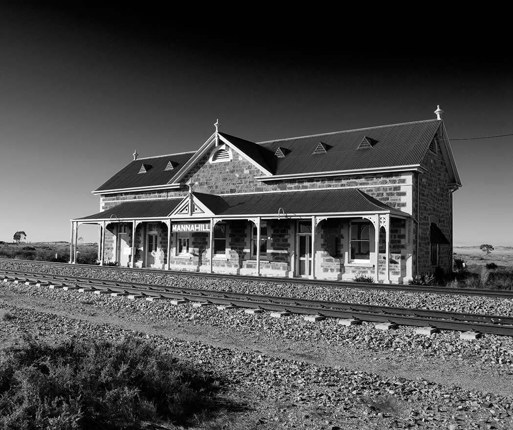
1. PETERBOROUGH TO MANNA HILL 130km (1.22hr) Manna hill railway station – Barrier Hwy, Manna Hill SA 5440 On the right just when you come into town
Mornings were still bitterly cold but got out of the car for this little beauty, a great stone railway halfway between Peterborough and Broken hill.
.
.
2. MANNA HILL TO WHITE CLIFFS 405km (5hr) Via Mutawinji & Whipstick dirt rds rd – White Cliffs Underground Motel 129 Smiths Hill, White Cliffs NSW 2836 – Small break at the park in Broken Hill
Sometimes it’s great not knowing your left from right, on leaving Broken Hill we ended up on the Broken Hill to White Cliffs dirt road which was not on our detailed trip plan. Not bad though, still ended up at the same destination. (another option if wet weather is via Wilcannia)
However, not a single car was seen for at least the first 1.5 hours (sweet, just the outback and us)….. that was until we pulled over for B to do a pee. The spanky new interior is now a nice shade of bull dust red courtesy of the ute that literally appeared from nowhere (they drive fast on the dirt roads way out here)


By god do things get real on this stretch of landscape, now gorgeous shades of colour and the wildlife….. emus, kangaroos, bobtails, birds, cattle, goats and the piece de resistance…large wedge-tailed eagles feasting on the road.
.


